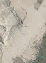
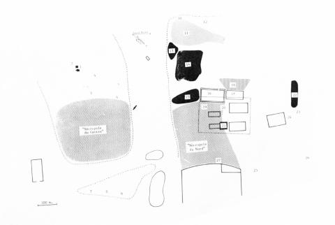
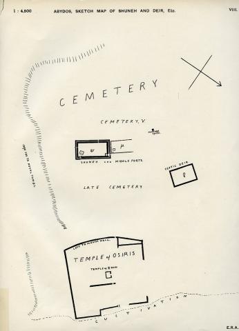
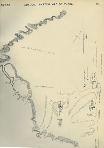
Key to Map of Excavations in the Abydos Cemeteries (see: Abydos cemetery excavation map in the gallery from Snape, 1986).
1 = Egypt Exploration Fund Southern Dig House, with the “Well and Dog Hypogeum” to the east of it
2 = Frankfort excavations
3 = Amélineau excavation ‘5’ and ‘6’
4 = Frankfort excavations
5 = Peet Cemetery ‘E’
6 = Petrie Cemetery ‘G’
7 = Ayrton and Loat Cemetery ‘F’
8 = Peet Cemetery ‘T’
9 = Peet Cemetery ‘R’
10 = Neferhotep Stela (Mace and Randall-MacIver excavations)
11= Mace and Randall-MacIver Cemetery ‘D’
12 = Amélineau excavations
13 = Peet Cemeteries ‘X’, ‘B’, ‘C’, and ‘F’
14 = Garstang Cemetery ‘E’
15 = Peet Cemeteries ‘O’, ‘W’, and ‘Z’
16 = Currelly Cemetery ‘w’
17 = Currelly Cemetery ‘m’
18 = Currelly Cemetery ‘v’
19 = Peet Cemetery ‘Y’
20 = Amélineau excavations ‘3’
21 = Peet Cemetery ‘S’
22 = Peet Cemeteries ‘K’, ‘L’, and ‘N’
23 = Amélineau excavations ‘4’, “es-Zein”
24 = Peet Cemetery ‘M’
25 = Amélineau excavations ‘1’
26 = Peet Cemetery ‘D’
27 = Pennsylvania/Yale excavations
Catalogue of antiquities from excavations at Abydos: found by the Egypt Exploration Found and the Egyptian Research Account ; exhibited [...] at University College, Gower St., London, W.C., July 2nd to July 28th, 1900. 1900. London.
Catalogue of antiquities of the earliest dynasties: found by Prof. Flinders Petrie at Abydos, Mr Randall-MacIver at El Amrah (Egypt Exploration Fund) and Mr J. Garstang at Beit Khallaf (Egyptian Research Account), 1901; exhibited at University College, Gower Street, London, July 1st to 27th. 1901. London.
Catalogue of Egyptian antiquities : found by Prof. Flinders Petrie at Abydos and Drs Grenfell and Hunt in the Fayum (Egypt Exploration Fund) and drawings from the temple of the kings (Sety I) (Egyptian Research Account), 1902 ; exhibited at University College, Gower Street, London, July 1st to 26th. 1902. London.
Catalogue of Egyptian antiquities : found by Prof. Flinders Petrie at Abydos and Drs Grenfell and Hunt at El Hibeh, Oxyrhynchus, &c. (Egypt Exploration Fund) and drawings from the Osireion (Egyptian Research Account), 1903; exhibited at University College, Gower Street, London, July 1st to 25th. 1903. London.
Catalogue of exhibition of antiquities: found by the officers of the Egypt Exploration Fund at Abydos and Mahasna; exhibited at King's College, Strand, July 8th to July 31st, 1909 / Egypt Exploration Fund. 1909. London : Egypt Exploration Fund.
Catalogue of an exhibition of antiquities: found by the officers of the Egypt Exploration Fund at Abydos and at Sidmant, etc., 1909-10 ; exhibited at King's College, Strand, July 7th to July 23rd / Egypt Exploration Fund. 1910. London : Egypt Exploration Fund.
Catalogue of Egyptian antiquities: found by Prof. Flinders Petrie and students at Abydos and Oxyrhynkhos, 1922 ; exhibited at University College, Gower St., London, July 3rd to July 29th / British School of Archaeology in Egypt. 1922. London: BSAE.
Exhibition of antiquities from Abydos and Tell el-Amarna, 1925-1926: exhibited at the rooms of the Society of Antiquaries, Burlington House, July 5th to July 24th, 1926, Egypt Exploration Society. London : Egypt Exploration Society.
Catalogue of the Egypt Exploration Society's exhibition of the results of the recent work at Abydos, Amarna & Armant: Wellcome Historical Medical Museum, 17th June to 27th July, 1932. London: Egypt Exploration Society.
Baines, John 1990. Recording the temple of Sethos I at Abydos in Egypt. Bulletin of the Ancient Orient Museum 11, 65-95.
Baines, John 2001. Colour use and the distribution of relief and painting in the Temple of Sety I at Abydos. In Davies, W. V. (ed.), Colour and painting in ancient Egypt, 145-157. London: British Museum Press.
Bestock, Laurel 2011. The first kings of Egypt: the Abydos evidence. In Teeter, Emily (ed.), Before the pyramids: the origins of Egyptian civilization, 137-144. Chicago: The Oriental Institute of the University of Chicago.
Brand, Peter J. 2000. The monuments of Seti I: epigraphic, historical and art historical analysis. Probleme der Ägyptologie 16. Leiden: Brill.
Calverley, Amice M. and Myrtle F. Broome 1933. The temple of king Sethos I at Abydos, volume I: the chapels of Osiris, Isis and Horus. London; Chicago: Egypt Exploration Society; University of Chicago Press.
Calverley, Amice M. and Myrtle F. Broome 1935. The temple of king Sethos I at Abydos, volume II: the chapels of Amen-Rē', Rē'-Ḥarakhti, Ptaḥ, and King Sethos. London; Chicago: Egypt Exploration Society; University of Chicago Press.
Calverley, Amice M. and Myrtle F. Broome 1938. The temple of king Sethos I at Abydos, volume III: the Osiris complex. London; Chicago: Egypt Exploration Society; University of Chicago Press.
Calverley, Amice M. and Myrtle F. Broome 1958. The temple of King Sethos I at Abydos, volume IV: the second hypostyle hall. London; Chicago: Egypt Exploration Society; University of Chicago Press.
Dreyer, Günter 2011. Tomb U-J: a royal burial of Dynasty 0 at Abydos. In Teeter, Emily (ed.), Before the pyramids: the origins of Egyptian civilization, 127-136. Chicago: The Oriental Institute of the University of Chicago.
Frankfort, Henri 1933.The cenotaph of Seti I at Abydos. 2 vols. London: Egypt Exploration Society.
Garstang, John 1901. El Arábah: a cemetery of the Middle Kingdom; survey of the Old Kingdom temenos; graffiti from the temple of Sety. British School of Archaeology in Egypt and Egyptian Research Account [6] (6th year). London: Bernard Quaritsch.
Garstang, John 1909. Excavations at Abydos, 1909: preliminary description of the principal finds. Annals of Archeology and Anthropology 2, 125-129.
Murray, Margaret A. 1904. The Osireion at Abydos. British School of Archaeology in Egypt and Egyptian Research Account [9] (9th year). London: Bernard Quaritch.
Naville, Edouard 1914. The cemeteries of Abydos. Part I: 1909-1910. The mixed cemetery and Umm el-Ga'ab. Memoir of the Egypt Exploration Fund 33. London: Egypt Exploration Fund.
O'Connor, David 2009. Abydos: Egypt's first pharaohs and the cult of Osiris. New aspects of antiquity. London: Thames & Hudson.
Peet, T. Eric 1914. The cemeteries of Abydos. Part II: 1911-1912. Memoir of the Egypt Exploration Fund 34. London: Egypt Exploration Fund.
Peet, T. Eric and W. L. S. Loat 1913. The cemeteries of Abydos. Part III: 1912-1913. Memoir of the Egypt Exploration Fund 35. London: Egypt Exploration Fund.
Petrie, Flinders 1925. Tombs of the courtiers and Oxyrhynkhos. British School of Archaeology in Egypt and Egyptian Research Account [37] (28th year). London: British School of Archaeology in Egypt; Bernard Quaritch.
Petrie, W. M. Flinders 1900-1901. The royal tombs of the First Dynasty, 3 vols. Memoir of the Egypt Exploration Fund 18. London: Egypt Exploration Fund; Kegan Paul, Trench, Trübner & Co.
Petrie, W. M. Flinders, E. R. Ayrton, C. T. Currelly, and A. E. Weigall 1902-1904. Abydos, 3 vols. Memoir of the Egypt Exploration Fund 22; 24. London: Egypt Exploration Fund; Kegan Paul, Trench, Trübner & Co.
Randall-MacIver, David and Mace, A. C. 1902. El Amrah and Abydos, 1899-1901. London: Egypt Exploration Fund.
Sawy, Ahmed el- 2003. A new discovery at the Sety I temple in Abydos. In Hawass, Zahi and Lyla Pinch Brock (eds), Egyptology at the dawn of the twenty-first century: proceedings of the Eighth International Congress of Egyptologists, Cairo, 2000 1, 424-431. Cairo; New York: American University in Cairo Press.
Snape, Steven 1986. Mortuary assemblages from Abydos. D.Phil thesis, University of Liverpool.
Stevenson, Alice 2009. The predynastic cemeteries of Abydos. Egyptian Archaeology 34, 25-26.

